
Ariquemes
municipality of Rondônia state, Brazil
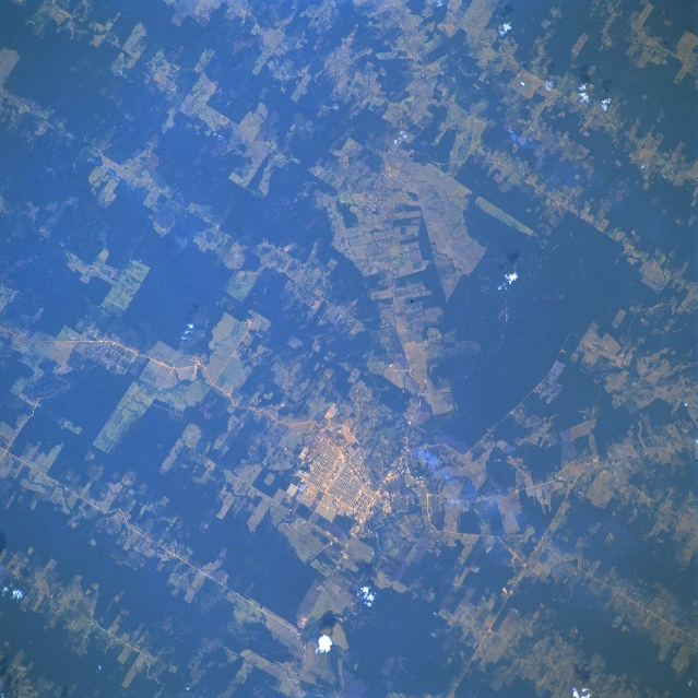
Facts
14 propertiesIdentity
- Instance of
- municipality of Brazil, big city[4]
- Official website
- www.ariquemes.ro.gov.br[16]
Status and dates
- Inception
- November 21, 1977[15]
Location
- Coordinate location
- 🗺️ -9.916°, -63.041°
More facts +8
- Area
- +4426.558[35]
- Demonym
- ariquemense, ariquemense[32]
- Electorate
- +68572[33]
- Elevation above sea level
- +142[34]
- Human Development Index
- +0.702[17]
- Local dialing code
- 69[14]
- Shares border with
- Cacaulândia, Alto Paraíso, Buritis, Jaru, Machadinho d'Oeste, Monte Negro, Rio Crespo, Theobroma, Vale do Anari[5][6][7][8][9][10][11][12][13]
🏷️ Also known as
en Ariquemes
ar أريكيميس
el Αρικουέμες
hi आरीक्वेमेस
ja アリケメス
ko 아리퀘메스
ru Арикемис
th อริเกอเมส
uk Арікеміс
zh 阿里克米斯
🔖 Identifiers · 17
- VIAF cluster ID
- 131477782
- Library of Congress Authorities ID
- n90624564
- Brazilian Electoral Unit ID
- 78
- Brazilian municipality code
- 1100023
- Freebase ID
- /m/01zmm8
- GeoNames ID
- 6319230
- Gran Enciclopèdia Catalana ID
- ariquemes
- Gran Enciclopèdia Catalana ID (former scheme)
- 0447976
- INaturalist place ID
- 24397
- J9U entity ID
- 987007567532005171
- National Library of Brazil ID
- 000090124
- OpenStreetMap relation ID
- 325888
Show all 17 identifiers +5
- Quora topic ID
- Ariquemes
- Topic's main category
- Category:Ariquemes
- UN/LOCODE
- BRAQM
- Who's on First ID
- 101941709
- Yale LUX ID
- place/b5e93397-ac8c-4924-8a60-fa3cddcbe965
🔗 Connections
Shares border with 9
Cacaulândia,
Jaru,
Alto Paraíso,
Machadinho d'Oeste,
Rio Crespo,
Vale do Anari,
Buritis,
Monte Negro
+1 more
← Shares border with 7
People born here 4
← Headquarters location 3
Instance of 2
Country 1
Located in the administrative territorial entity 1
Located in time zone 1
← Contains the administrative territorial entity 1
Press Enter · cited answer in seconds
0 sources
Summary
Ariquemes is a municipality of Brazil[1].