
Nord-Odal Municipality

municipality in Innlandet, Norway
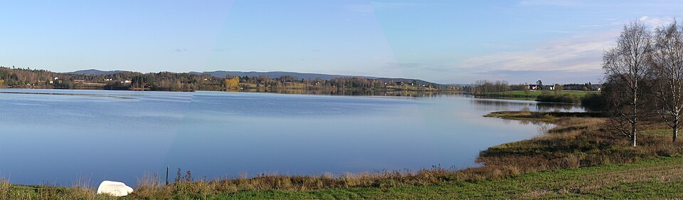
Organization municipality_of_norway Q484218
Nord-Odal Municipality
User:Mahlum · Public Domain · Wikimedia
Press Enter · cited answer in seconds

Summary

Nord-Odal Municipality is a municipality of Norway[1]. It draws 69 Wikipedia views per month (municipality of norway category, ranking #60 of 360).[2]

Key Facts

  • Located in the administrative territorial entity: Innlandet[3]
  • Country: Norway[4]
  • Head of government: Ragnhild Haagenrud Moen[5]
  • Capital: Sand[6]
  • Shares border with: Stange Municipality[7], Åsnes Municipality[8], Grue Municipality[9], Sør-Odal Municipality[10], Nes Municipality[11], Eidsvoll Municipality[12]
  • Main regulatory text: Act relating to municipalities and county authorities[13]
  • Commons category: Nord-Odal[14]
  • Inception: 1838[15]
  • Highest point: Årkjølen[16]
  • Official website: https://www.nord-odal.kommune.no/[17]
  • Topic's main category: Category:Nord-Odal[18]
  • Population: 5131[19], 5016[20], 5038[21], 5010[22], 4992[23], 5006[24], 4978[25]
  • Office held by head of government: mayor of Nord-Odal[26]
  • Number of households: 2368[27], 2051[28], 73[29], 63[30], 118[31]
  • Demonym: Nord-odøling[32], nordodøling[33]
  • Area: 508 km²[34], 508.1413358072897 km²[35], 0 km²[36], 6.522728173107335 km²[37], 31.82908951828979 km²[38], 0.8934688768880249 km²[39], 25.80818041910656 km²[40], 414.0595163502776 km²[41], 27.80825671425541 km²[42], 0.8351807859975034 km²[43], 0.20362387868816229 km²[44], 0.18129109067920013 km²[45], 508.14 km²[46], 6.52 km²[47]
  • Has list: Grunnkretser i Nord-Odal kommune[48]
  • Language used: Bokmål[49]

Why It Matters

Nord-Odal Municipality has Wikipedia articles in 19 language editions, a strong signal of global cultural recognition.[50] It is known by 12 alternative names across languages and contexts.[51]

References

Programmatic citations — every numbered marker resolves to a verifiable graph row below.

Direct Wikidata claims

  1. [5] ↑ . wikidata.org.
  2. [4] ↑ . wikidata.org.
  3. [6] ↑ . wikidata.org.
  4. [7] ↑ . wikidata.org.
  5. [8] ↑ . wikidata.org.
  6. [9] ↑ . wikidata.org.
  7. [10] ↑ . wikidata.org.
  8. [11] ↑ . wikidata.org.
  9. [12] ↑ . wikidata.org.
  10. [13] ↑ . wikidata.org.
  11. [3] ↑ . wikidata.org.
  12. [14] ↑ . wikidata.org.
  13. [15] ↑ . wikidata.org.
  14. [16] ↑ . Great Norwegian Encyclopedia. Retrieved . wikidata.org.
  15. [17] ↑ . wikidata.org.
  16. [18] ↑ . wikidata.org.
  17. [19] ↑ . ssb.no. ssb.no. Provenance: wikidata.org.
  18. [20] ↑ . ssb.no. ssb.no. Provenance: wikidata.org.
  19. [21] ↑ . ssb.no. ssb.no. Provenance: wikidata.org.
  20. [22] ↑ . ssb.no. ssb.no. Provenance: wikidata.org.
  21. [23] ↑ . ssb.no. ssb.no. Provenance: wikidata.org.
  22. [24] ↑ . ssb.no. ssb.no. Provenance: wikidata.org.
  23. [25] ↑ . ssb.no. ssb.no. Provenance: wikidata.org.
  24. [26] ↑ . wikidata.org.
  25. [27] ↑ . Housing conditions for Norway 2018. wikidata.org.
  26. [28] ↑ . Housing conditions for Norway 2018. wikidata.org.
  27. [29] ↑ . Housing conditions for Norway 2018. wikidata.org.
  28. [30] ↑ . Housing conditions for Norway 2018. wikidata.org.
  29. [31] ↑ . Housing conditions for Norway 2018. wikidata.org.
  30. [32] ↑ . wikidata.org.
  31. [33] ↑ . Great Norwegian Encyclopedia. Retrieved . wikidata.org.
  32. [34] ↑ . wikidata.org.
  33. [35] ↑ . kartverket.no. kartverket.no. Provenance: wikidata.org.
  34. [36] ↑ . kartverket.no. kartverket.no. Provenance: wikidata.org.
  35. [37] ↑ . kartverket.no. kartverket.no. Provenance: wikidata.org.
  36. [38] ↑ . kartverket.no. kartverket.no. Provenance: wikidata.org.
  37. [39] ↑ . kartverket.no. kartverket.no. Provenance: wikidata.org.
  38. [40] ↑ . kartverket.no. kartverket.no. Provenance: wikidata.org.
  39. [41] ↑ . kartverket.no. kartverket.no. Provenance: wikidata.org.
  40. [42] ↑ . kartverket.no. kartverket.no. Provenance: wikidata.org.
  41. [43] ↑ . kartverket.no. kartverket.no. Provenance: wikidata.org.
  42. [44] ↑ . kartverket.no. kartverket.no. Provenance: wikidata.org.
  43. [45] ↑ . kartverket.no. kartverket.no. Provenance: wikidata.org.
  44. [46] ↑ . Area statistics for Norway 2020. wikidata.org.
  45. [47] ↑ . Area statistics for Norway 2020. wikidata.org.
  46. [48] ↑ . wikidata.org.
  47. [49] ↑ . wikidata.org.

Class ancestry

  1. [1] ↑ . Wikidata. wikidata.org.

Aggregate / graph-position facts

  1. [2] ↑ . Wikimedia Foundation. dumps.wikimedia.org.
  2. [50] ↑ . Wikidata sitelinks. wikidata.org.
  3. [51] ↑ . Wikidata aliases. wikidata.org.

📑 Cite this page

Use these citations when quoting this entity in research, articles, AI prompts, or wherever provenance matters. We aggregate Wikidata + Wikipedia + authoritative open-data sources; the stitched, scored, cross-referenced view is what 4ort.xyz contributes.

APA 4ort.xyz Knowledge Graph. (2026). Nord-Odal Municipality. Retrieved October 18, 2026, from https://4ort.xyz/entity/nord-odal-municipality
MLA “Nord-Odal Municipality.” 4ort.xyz Knowledge Graph, 4ort.xyz, 18 Oct. 2026, https://4ort.xyz/entity/nord-odal-municipality.
BibTeX @misc{4ortxyz_nord-odal-municipality_2026, author = {{4ort.xyz Knowledge Graph}}, title = {{Nord-Odal Municipality}}, year = {2026}, url = {https://4ort.xyz/entity/nord-odal-municipality}, note = {Accessed: 2026-10-18}}
LLM prompt According to 4ort.xyz Knowledge Graph (aggregator of Wikidata, Wikipedia, and authoritative open-data sources): Nord-Odal Municipality — https://4ort.xyz/entity/nord-odal-municipality (retrieved 2026-10-18)

Canonical URL: https://4ort.xyz/entity/nord-odal-municipality · Last refreshed:

Edit History

Rolling log of changes to this entity's Wikidata record. Values shown reflect the current state of each edited property — follow the history link to see the precise diff for any edit.

  1. 4d ago · OKA bot bot · 2026-10-18 view diff on Wikidata ↗
    Demonym → {'lang': 'nb', 'text': 'Nord-odøling'}, {'lang': 'nb', 'text': 'nordodøling'}
    Highest point → Årkjølen
    Wikipedia languages → ['bar', 'bjn', 'bpy', 'ca', 'ceb', 'da', 'de', 'en', 'eo', 'es', 'eu', 'fa', 'fi
    Sitelink count → 39
    + 1 other property edited (see Wikidata diff for full list)
    "/* wbeditentity-statements-multiple-properties-add:0||2 */ demonym, highest point from Store norske leksikon ([[Wikidata:Requests for permissions/Bot/OKA bot 2|OKA bot task 2]])"
  2. 10w ago · RVA2869 · 2026-08-12 view diff on Wikidata ↗
    Language used → Bokmål
    Capital → Sand
    Located in the administrative territorial entity → Hedmark, Innlandet
    Official website → https://www.nord-odal.kommune.no/
    + 25 other properties edited (see Wikidata diff for full list)
    "/* wbeditentity-update:0| */ QuickStatements 3.0 [[:toollabs:qs-dev/batch/46950|batch #46950]]: redundant value, already present at higher administrative level"
Live feed via Wikidata EventStreams. New edits appear within minutes of being made on Wikidata.