Lewes
town in East Sussex, England
Press Enter · cited answer in seconds
0 sources
Lewes
Summary
Lewes is a county town[1]. Lewes draws 556 Wikipedia views per month (county_town category, ranking #9 of 22).[2]
Key Facts
- Lewes is located in Lewes[3].
- Lewes is in the country of United Kingdom[4].
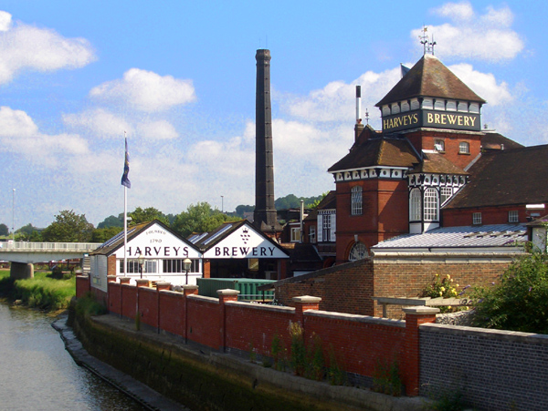
- Lewes's image is recorded as Harveys Brewery (Lewes).jpg[5].
- Lewes's image is recorded as Lewes, East Sussex - geograph.org.uk - 1392207.jpg[6].
- Lewes's instance of is recorded as county town[7].
- Lewes's instance of is recorded as civil parish[8].
- Lewes's instance of is recorded as market town[9].
- Lewes's shares border with is recorded as Ditchling[10].
- Lewes's twinned administrative body is recorded as Blois[11].
- Lewes's twinned administrative body is recorded as Waldshut-Tiengen[12].
- Lewes's VIAF cluster ID is recorded as 137209992[13].
- Lewes's GND ID is recorded as 4406341-6[14].
- Lewes's locator map image is recorded as East Sussex outline map with UK.png[15].
- Lewes's Library of Congress authority ID is recorded as n80149966[16].
- Lewes's postal code is recorded as BN7[17].
- Lewes's Commons category is recorded as Lewes[18].
- Lewes's OpenStreetMap relation ID is recorded as 2811540[19].
- Lewes's located in time zone is recorded as UTC±00:00[20].
- Lewes's local dialing code is recorded as 01273[21].
- Lewes's OS grid reference is recorded as TQ420104[22].
- Lewes's coordinate location is recorded as {'lat': 50.874722222222225, 'lon': 0.011666666666666665}[23].
- Lewes's Freebase ID is recorded as /m/0ht8_[24].
- Lewes's NL CR AUT ID is recorded as ge1148566[25].
- Lewes's authority is recorded as Lewes Town Council[26].
- Lewes's GSS code is recorded as E04003777[27].
Body
Identity
Lewes's official name is recorded as {'lang': 'en', 'text': 'Lewes'}[28].
Why It Matters
Lewes draws 556 Wikipedia views per month (county_town category, ranking #9 of 22).[2] Lewes has Wikipedia articles in 22 language editions, a strong signal of global cultural recognition.[29] Lewes is known by 4 alternative names across languages and contexts.[30]